

BEIJING – China's national observatory on Sunday activated a red alert -- the highest level in the country's typhoon warning system -- as Typhoon Dolphin approaches.
Typhoon Dolphin is forecast to make landfall along the country's east coast from Zhoushan in Zhejiang province to Fuding in Fujian province, according to the National Meteorological Center (NMC).
As of 10:00 am Sunday, the typhoon's center was about 215 km offshore east of Wenzhou in Zhejiang, with maximum winds near the center reaching the speed of 45 meters per second, the NMC said.
The NMC forecast that Typhoon Dolphin will move westward at a speed of 20 to 25 km per hour. After landfall, it is expected to move west-northwestward and gradually weaken.
From Sunday to Wednesday, the typhoon is expected to bring torrential rains to multiple regions, including Fujian, Zhejiang and Shanghai, as well as Shandong, Tianjin and Beijing. The affected areas will also experience short-duration heavy rainfall and thunderstorms with gale-force winds.
In response to the typhoon, China's meteorological authority on Sunday upgraded its emergency response for severe meteorological disasters from Level III to Level II.
ALSO READ: Typhoon Dolphin threatens eastern China amid active cyclone season
Zhejiang raised its typhoon emergency response to Level I, the highest level, on Saturday night, according to the provincial flood control and drought relief headquarters.
Although Dolphin is yet to make landfall, it has already brought heavy rains and strong winds to parts of Zhejiang, including Ningbo, Taizhou, Wenzhou and Lishui, said Jia Yan, chief forecaster at the Zhejiang Meteorological Observatory.
The Ministry of Water Resources and the China Meteorological Administration on Saturday evening jointly issued a red alert for flash floods in 23 contiguous counties, cities and districts in Zhejiang. The Ministry of Water Resources also upgraded the province's flooding emergency response from Level IV to Level III.
More than 4,000 local monitors have been deployed to inspect over 7,500 areas considered at risk of landslides and other geological disasters.
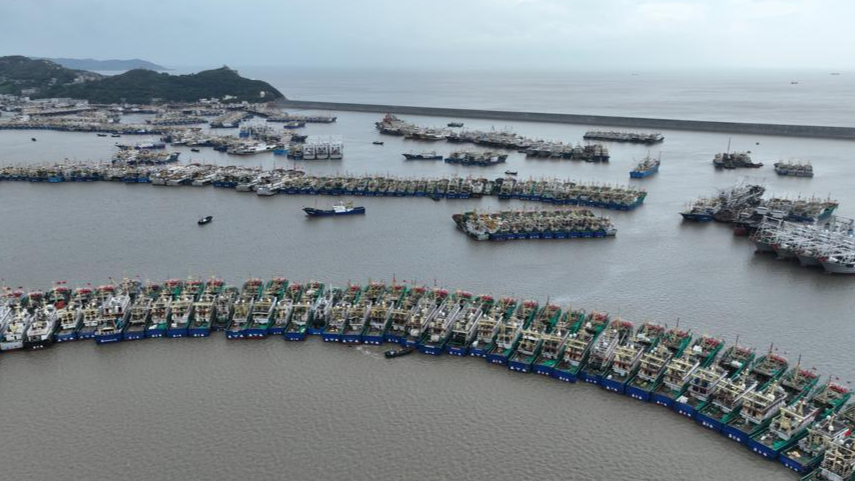
The province had suspended services on all 162 of its passenger ferry routes, halted work at all 193 offshore projects, and called 474 construction vessels to port by Friday morning.
READ MORE: Typhoon Dolphin forecast to make landfall in East China
In Fujian province, 98,900 people had been relocated to safety from risky areas as of 6 pm Saturday. Authorities had suspended 55 passenger ferry routes and halted work at 115 offshore construction sites. All 1,210 registered fishing boats in the coastal city of Fuding had returned to port.
Shanghai issued a blue typhoon alert Friday, with forecasters warning that the storm could bring strong winds and heavy rain to the city for as long as four days. Some train services in the Yangtze River Delta will be suspended from Sunday.
Authorities in Shanghai also have evacuated 30,300 residents from risky areas and more people are expected to be evacuated on Sunday. As of Saturday afternoon, over 20 scenic sites in Shanghai have been temporarily closed.
The typhoon is expected to disrupt air traffic and lead to cancellations of 1,384 inbound and outbound flights, or nearly 60 percent of all flights at the two airports in Shanghai on Sunday, Shanghai Airport (Group) Co, Ltd said on Saturday night.
Shanghai Pudong International Airport and Shanghai Hongqiao International Airport planned to cancel 871 flights and 513 flights, respectively, on Sunday.
Compared with Typhoon Bavi, which made landfall in the country in July, Typhoon Dolphin may bring stronger winds and heavier rainfall, said Xu Yinglong, chief forecaster at the National Meteorological Center.
China has a four-tier color-coded weather warning system for typhoons, with red representing the most severe, followed by orange, yellow and blue. It also has a four-tier emergency response system, with Level I being the highest.
