

Typhoon Dolphin, which weakens to a tropical storm, continues to bring rainfall
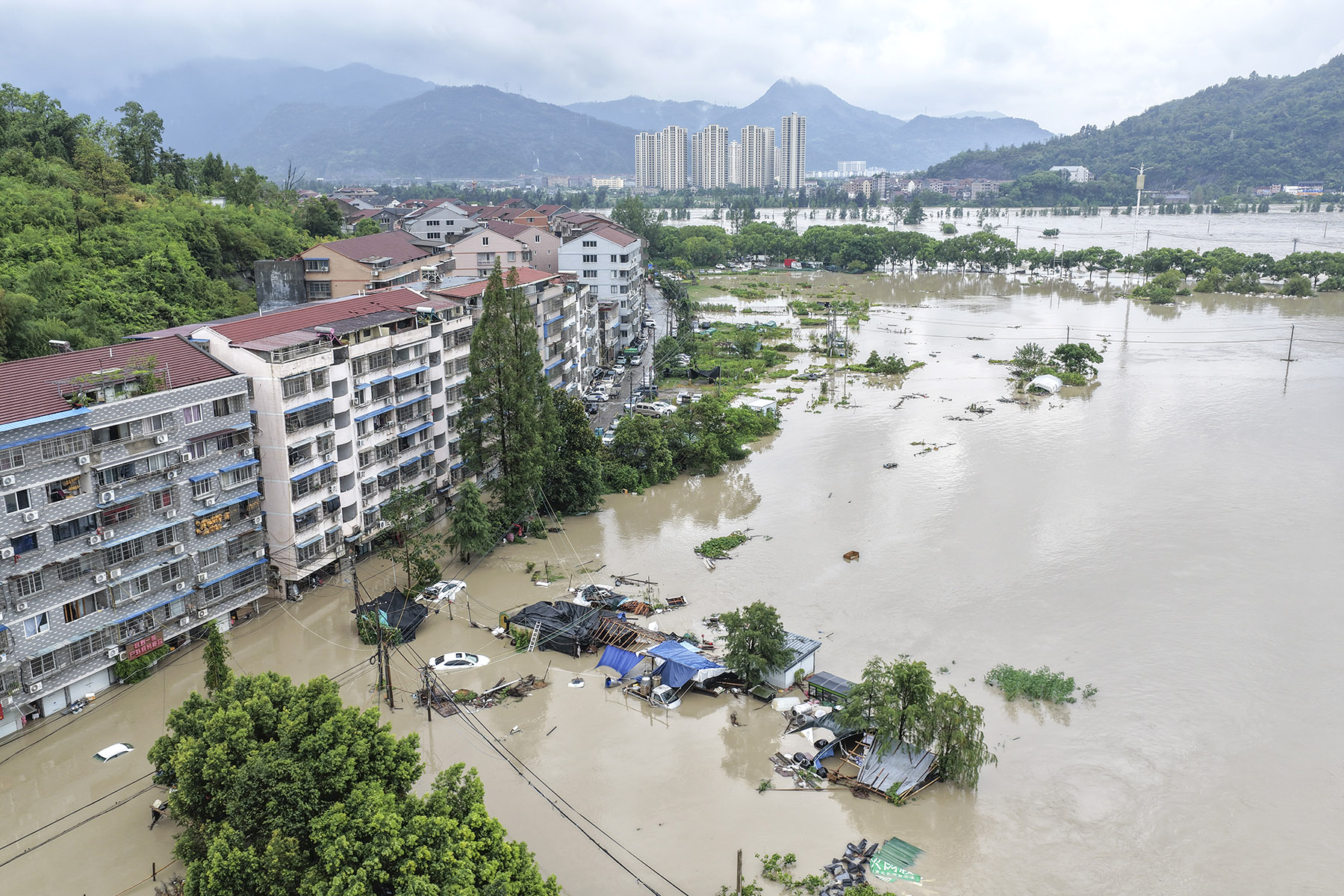
Typhoon Dolphin has weakened to a tropical storm after making two landfalls in eastern China's Zhejiang province, but its moisture-rich circulation is continuing to move northwestward, threatening to unleash potentially extreme rainfall across parts of northern China, meteorologists said on Monday.
Dolphin, the 13th typhoon of the year, made two landfalls in Zhejiang on Sunday evening and weakened as it moved inland. But unlike many tropical cyclones that rapidly dissipate after landfall, its extensive cloud system and abundant moisture have allowed its remnants to persist and move northward and westward, said Zhang Fanghua, chief forecaster at the National Meteorological Center.
READ MORE: Hundreds of thousands evacuated as typhoon brings heavy rain to eastern China
"The residual circulation could bring persistent and extreme rainfall to parts of eastern and northern China," Zhang said.
Dolphin's movement is forecast to significantly slow after Tuesday, and around Wednesday, its remnants could stall near the border area of Hubei, Henan and Anhui provinces.
The residual vortex is expected to interact with an upper-level trough in the westerlies and a cold-air system, potentially triggering a new round of heavy rainfall, she added.
The heavy rain will cover much of Shanghai as well as Zhejiang, Jiangsu, Anhui, Hubei, Henan and Shandong provinces through Tuesday.
As the rain belt moves northward on Tuesday and Wednesday, some locations in Henan, Hebei and Shanxi could receive 400 to 600 millimeters of rain, with the possibility of exceptionally heavy downpours.

Meteorologists warned that the threat will also extend into the Beijing-Tianjin-Hebei region.
Zhai Liang, chief forecaster at the Beijing Meteorological Service, said that warm and humid air from Dolphin's outer circulation, combined with cold air, is expected to bring heavy rain to the region from Tuesday through Thursday.
"Beijing is expected to receive the strongest rainfall from early Wednesday to Wednesday night," Zhai said, adding that red alerts for heavy rain have been issued in seven districts including Tongzhou, Daxing, Fangshan and Mentougou.
On Monday, the National Meteorological Center continued to issue an orange alert for heavy rain, the second-highest warning level. Isolated areas in northern Hubei could receive 250 to 270 mm during the 24-hour period between Monday afternoon and Tuesday afternoon.
ALSO READ: Typhoon Dolphin hits Zhejiang, rain to move northward
The Ministry of Emergency Management has activated a Level IV — the least-severe level in China's four-tier emergency response system — flood control emergency response in Hebei, Henan, Hubei and Shandong amid rising risks of flooding and geological disasters over the next three days.
Local governments are being urged to closely monitor updated weather forecasts and strengthen preparations for flooding, landslides, mudslides and urban waterlogging, particularly in mountainous areas and along rivers.
The Ministry of Agriculture and Rural Affairs on Monday renewed a warning over the risk of farmland waterlogging, which is expected to affect parts of Henan from Monday night through Saturday.
The Shanghai Metro resumed services on suspended sections from Monday afternoon as Typhoon Dolphin weakened and its wind impacts eased, while aboveground sections across the network continued to operate at reduced speeds for safety reasons.
Contact the writers at zhaoyimeng@chinadaily.com.cn
