

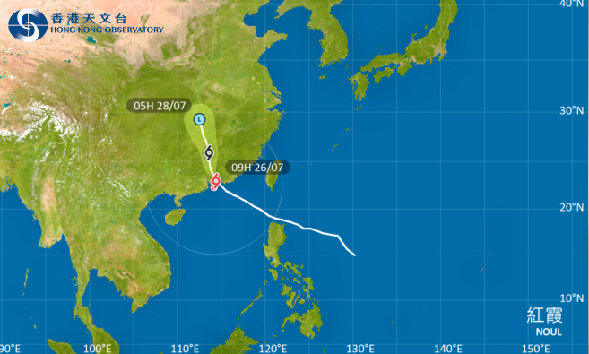
Hong Kong’s weather forecaster downgraded the T9 typhoon warning signal six hours after raising it on Sunday morning as Typhoon Noul lashed the city with gale-force winds and heavy showers.
The Hong Kong Observatory hoisted the Gale or Storm Signal No. 8 (T8) at 7:10 am as gales still affected many places in the territory even as Noul weakened progressively while it moved inland in Guangdong.
“The Gale or Storm Signal No. 8 will remain in force at least until noon. Depending on the degree of weakening of local winds, the Observatory will then consider issuing the Strong Wind Signal, No. 3,” the observatory said.
As of 9 am, Noul was centered about 80 kilometers north-northeast of the Hong Kong Observatory and was forecast to move northwest or north-northwest at about 15 kilometers per hour crossing inland Guangdong.
ALSO READ: HKO: 4 to 7 typhoons may hit Hong Kong this year
The observatory said Hong Kong will have frequent heavy squally showers and thunderstorms over the territory on Sunday while seas will be high with swells. It urged members of the public to stay away from the shoreline and avoid water sports.
In the past hour, the maximum sustained winds recorded at Cheung Chau, Lau Fau Shan and Star Ferry were 70, 68 and 64 kilometers per hour, respectively.
The HKO also issued the amber rainstorm signal at 5 am, warning that that heavy rain has fallen or is expected to fall generally over Hong Kong, exceeding 30 millimeters in an hour.
READ MORE: HKO: ‘Dim-sum’ among nine new names for this year's typhoons
According to the Hospital Authority, nine people – five males and four females – were injured during the typhoon period and received medical treatment at public hospitals.
The Home Affairs Department said 228 people have sought refuge at 29 temporary shelters in various districts while the government's 1823 Call Centre and the Fire Services Department received a total of 116 reports of fallen trees.
