
First summit of Qomolangma's north slope still carries weight 65 years on
Editor's note: China scientifically measured Qomolangma, the world's tallest peak also known as Mount Everest, for the first time on May 27, 1975. Fifty years on, we dedicate this page to generations of mountaineers and scientists, who inspire the world with their incredible resilience and bravery in pursuing the spirit of science under extreme conditions.
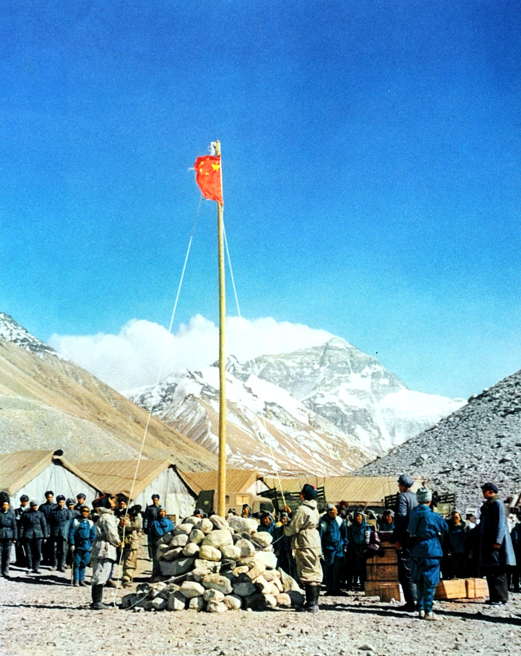
On May 25, 1960, three Chinese mountaineers summited Mount Qomolangma via the north slope, marking the first successful north-side ascent of the world's tallest mountain, also known as Mount Everest.
The idea of climbing Qomolangma was first proposed by the Central Committee of the Communist Party of the former Soviet Union, according to Yuan Fudong, deputy director of the industrial development department at the mountaineering management center of the General Administration of Sport of China.
At the time, the Soviet Union had advanced mountaineering expertise but lacked peaks above 8,000 meters within its borders. Given the good-neighborly friendship with China, the Soviets suggested a joint expedition to Qomolangma, Yuan said.
READ MORE: Young climber finds 'pure happiness' at top of world
But as Sino-Soviet relations deteriorated, the Soviet Union unilaterally withdrew from the project, cutting off high-altitude equipment and supplies. Meanwhile, India — becoming closer with the Soviets — launched its own attempt from the southern slope, according to Yuan.
Tall order
The Soviet withdrawal left China to figure out many problems on its own, Yuan said. Amid a period of severe economic difficulties, the government allocated $700,000-approved by then-Chinese president Liu Shaoqi and premier Zhou Enlai — to purchase mountaineering equipment from Europe.
Yet, without firsthand knowledge of Qomolangma's terrain, the purchasers relied on British expedition notes, guessing at equipment needs. This led to imprecise calculations for critical items like ropes and oxygen tanks, forcing last-minute purchases with compromised quality and suitability, Yuan added.
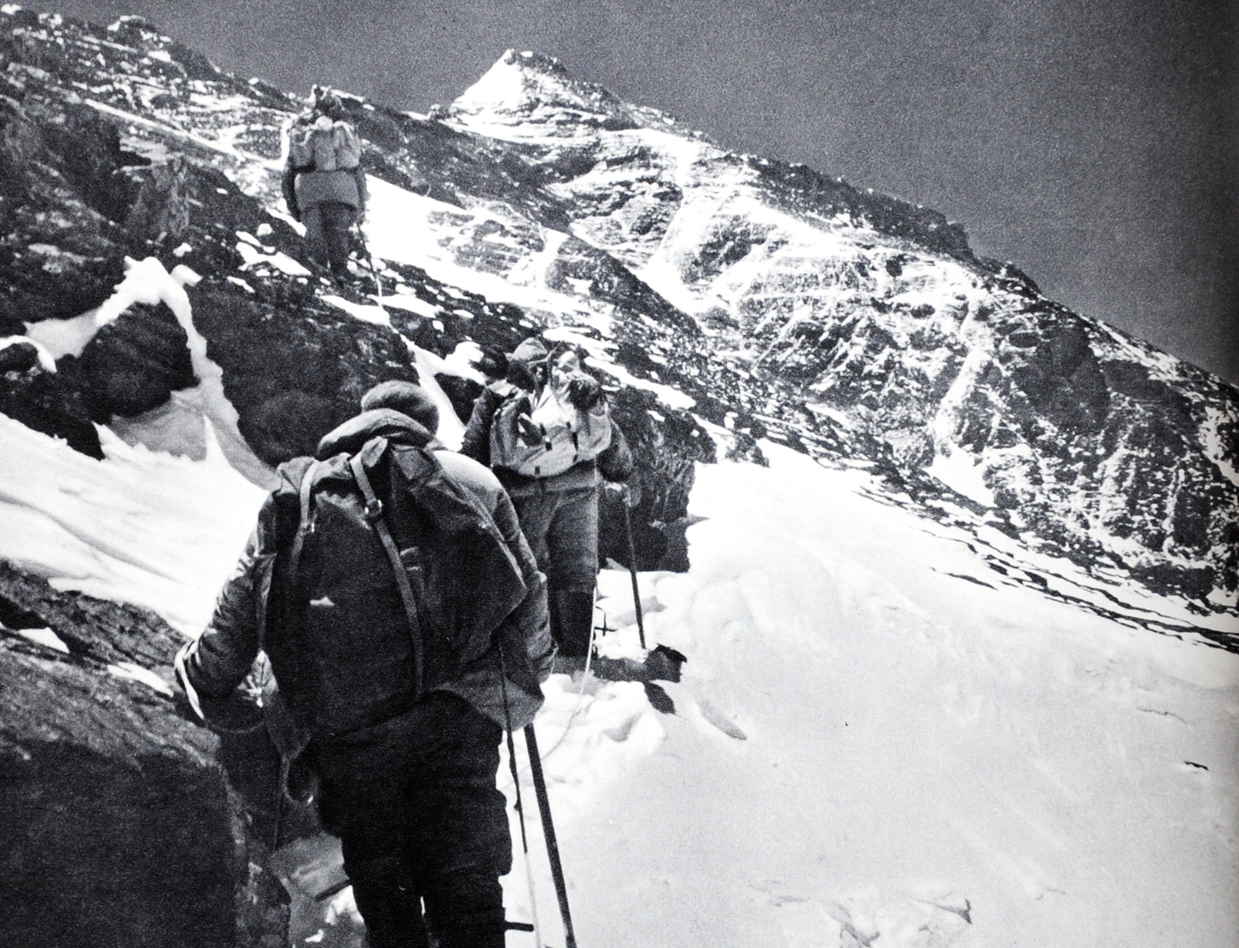
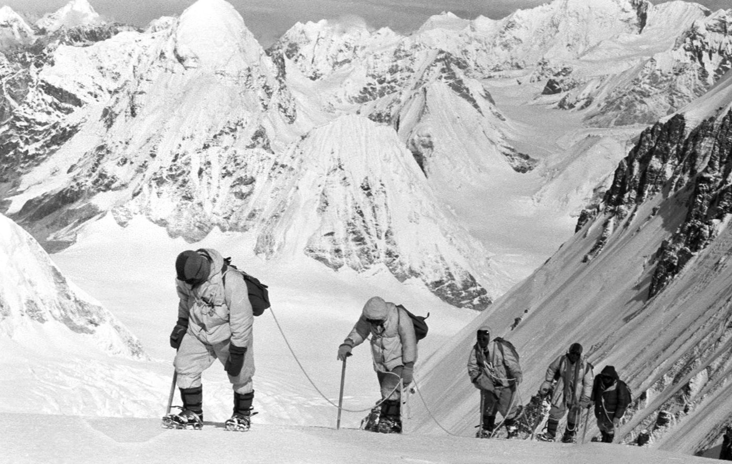
Despite all preparations, Qomolangma's north slope — dubbed "impassable even for birds" — was generally believed to be insurmountable, as it pushed every climber to their limits with its thin air, monthslong climbs, brutal winds, freezing cold and treacherous terrain.
Overcoming setbacks
To explore the northern route of Mount Qomolangma, China conducted three acclimatization expeditions starting in March 1960.
The first reached an altitude of 6,800 meters before encountering an impassable ice wall. The second reached over 7,200 meters but was halted by strong winds. The third reached over 8,600 meters but was forced to retreat due to severe frostbite and casualties, Yuan said.
These expeditions helped the team map the climbing route, establish camps and transport supplies, and accumulate crucial experience for their fourth summit attempt.
At 4:20 am on May 25, during the fourth expedition, Wang Fuzhou, Gonpo and Qu Yinhua — oxygen-depleted, fingers blackened by frostbite — summited in darkness, planting a Chinese national flag and leaving the footprints of the Chinese people atop the world's highest peak for the first time, Yuan said.
After descending, team members recounted the summit experience: when they reached the top of the visible rock, they mistakenly believed they had reached the summit and were overjoyed, according to Yuan.
However, as they looked west, a snow slope several meters higher appeared. Crossing it, they found themselves on a conical summit surrounded by endless white snow, with no higher ground visible — confirming they had reached Qomolangma's true peak, Yuan said.
Climbers today follow the same path, also needing to scale that rock before seeing the snow slope and reaching the summit.
Thus, even though no video footage of their summit was recorded due to nighttime conditions and camera issues, their detailed recollections proved the successful ascent and silenced skeptics, according to Yuan.
ALSO READ: Tourists again enjoy Tibet high life
Thanks to the feat achieved by the Chinese mountaineering team, the boundary treaty between the People's Republic of China and the Kingdom of Nepal — where the southern slope of the peak lies — was officially signed in 1961, resolving the historical boundary issues between the two countries, according to Xinhua News Agency.
As Gonpo later reflected: "We carried the nation's hopes on our backs. Even if only one of us remained, we would fight to the end and reach the summit."
Six decades on, their journey remains a testament to resilience and the unyielding spirit that lifts humanity to impossible heights.
Contact the writer at lipeixuan@chinadaily.com.cn